
Melbourne & Victoria
Same angles.
Clear dates.
Easy delivery.
Scheduled aerial photography for construction projects that can’t afford to miss a milestone.
Drone and aircraft. Delivered in 48 hours.
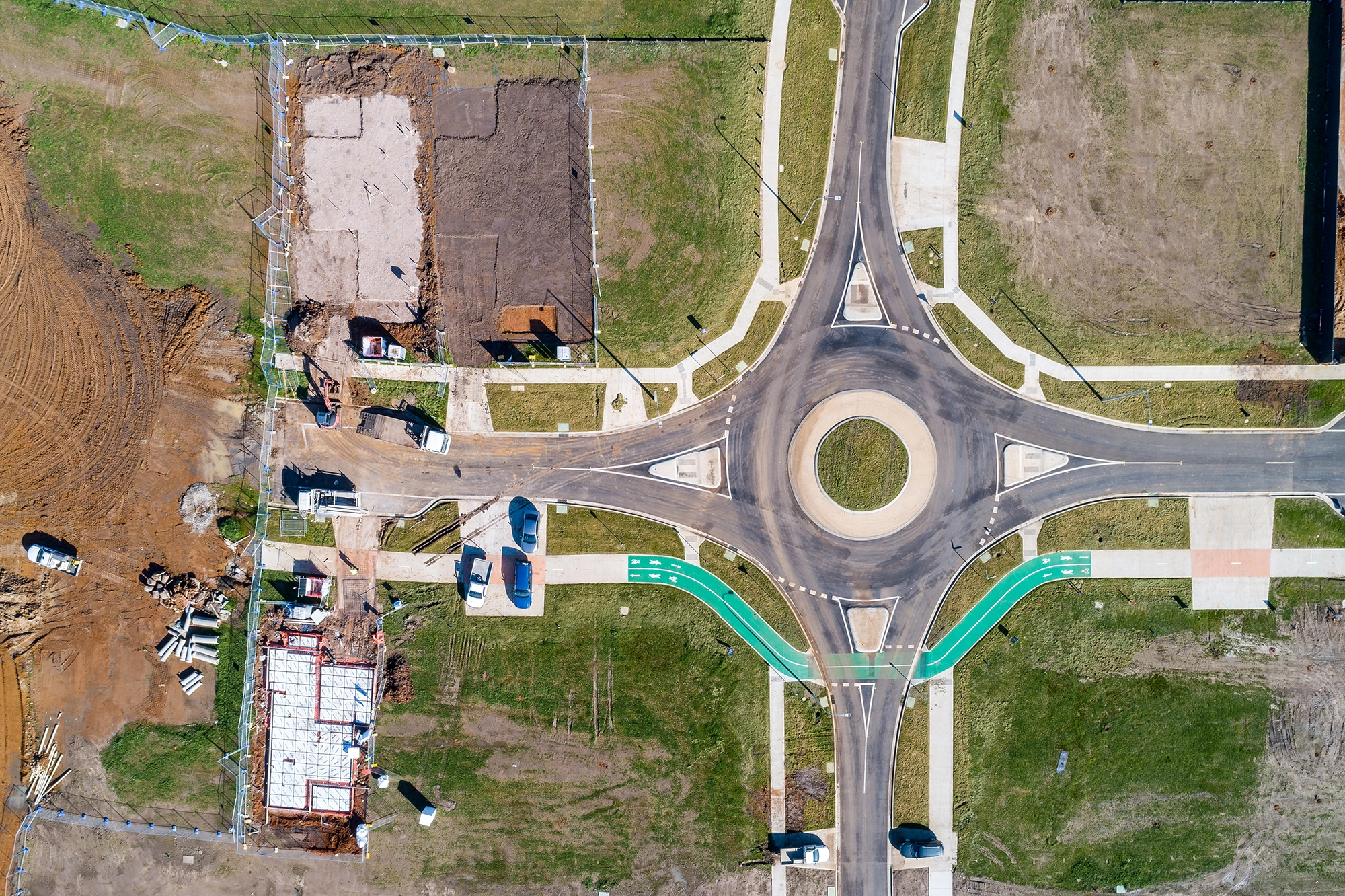
Most aerial photography is a one-off.
Builders and developers need more.
Consistent records. On their schedule. For the reports that matter.


Built for the people who run the project.
Not for hobbyists. For the teams responsible for serious construction and infrastructure projects across Melbourne and Victoria.
The record that protects your investment.
Predictable costing, quoted per job.
Any-weather means scheduled aircraft shoots can proceed in overcast or light rain conditions that may ground drone-only work.
Frequently Asked Questions
Do you use drones or aircraft — and what’s the difference?
Aerial Now primarily operates fixed-wing manned aircraft, which can fly in most weather conditions, cover large sites quickly, and operate across all of Victoria without the airspace restrictions that apply to drones. Drones are used selectively in areas where they are legally permitted under CASA regulations — typically lower-altitude work in open, uncontrolled airspace away from controlled aerodromes and restricted zones. When you book a shoot, we determine the right platform for your site’s location, size, and requirements.
Do you fly in bad weather?
Yes. Because we operate manned aircraft as our primary platform, weather is far less of a constraint than it is for drone-only operators. Aircraft fly in overcast, light rain, and conditions that would ground a drone entirely. Subscribers can choose an any-weather option so shoots go ahead on the scheduled date regardless of conditions — important for clients who need consistent monthly records rather than waiting for a clear day.
Are you CASA licensed and insured?
Yes. All operations are conducted under the appropriate CASA licensing and accreditation for both manned aircraft and drone work, including a Remote Operator’s Certificate (ReOC) for drone operations. We carry comprehensive public liability insurance. Certificates of currency are available on request — many councils and contractors require these before awarding work, and we have them ready.
Will the same angles be captured every visit?
Yes — on the first shoot we establish a set of reference angles for your site. Every subsequent visit replicates those angles, giving you a directly comparable record of construction progress across the life of the project. This consistency is what makes the imagery genuinely useful for reporting, rather than a collection of unrelated shots.
How quickly do I receive the images?
Processed, high-resolution images are delivered directly to your inbox within 48 hours of the shoot. Files are date-stamped, clearly labelled by angle, and ready for use in progress reports, lender packages, investor updates, and site documentation.
Can I set up a recurring schedule?
Yes. Monthly and quarterly subscription plans are available, and once confirmed we lock in your dates for the project duration — no need to re-book each time. Ad-hoc shoots are also available for clients who prefer to book around specific construction milestones rather than a fixed calendar.

Ready to put your sites on schedule?
Online booking. 2-minute form. Invoice follows.