Victoria-Wide
Infrastructure Aerial
Photography Victoria.
Aerial documentation for roads, utilities, government assets and
major infrastructure projects across Victoria. Drone and fixed-wing.
From road corridors to water treatment plants, aerial photography gives infrastructure operators, government agencies and asset managers a clear, current view of assets that are difficult or impossible to inspect from the ground. Drone for detail. Fixed-wing for distance. One provider for both.
Infrastructure aerial photography across every asset class.
We provide aerial documentation, inspection imagery, and visual asset records for infrastructure operators, government bodies, and asset owners across Victoria.
Roads, Bridges & Transport Corridors
Aerial documentation of road networks, intersections, bridges and transport corridors. Fixed-wing aircraft cover long corridors in a single flight; drones provide detailed inspection imagery at structures and pinch points.
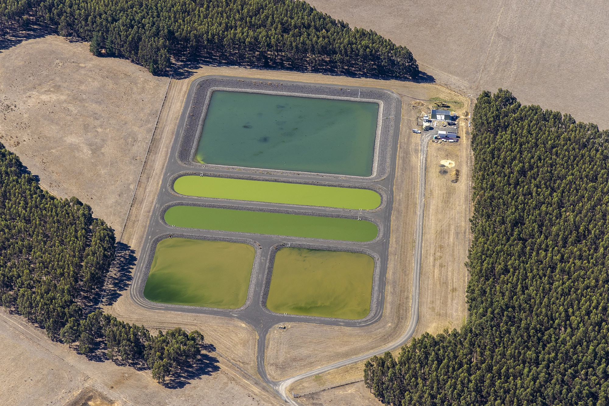
Power, Water & Telecommunications
Aerial photography of utility assets — substations, transmission corridors, water treatment facilities, pipelines and telecommunications infrastructure — for condition monitoring, asset registers and corporate reporting.
Government & Council Assets
Aerial photography and documentation for state and local government — foreshore reserves, parks, drainage networks, public infrastructure and land assets — supporting planning, reporting and asset management.
Major Infrastructure Projects
Scheduled aerial documentation for large-scale infrastructure projects — rail, road, and utility builds — providing a consistent visual record across the life of the program for stakeholders and reporting requirements.
Asset Condition & Inspection Imagery
High-resolution aerial imagery to support condition assessments and asset inspections — identifying visible deterioration, encroachment, or changes in site condition without the cost and access requirements of ground or manned inspections.
Land Corridors & Easements
Aerial photography of land corridors, easements and rights-of-way — covering pipeline routes, transmission easements and rail reserves across regional Victoria. Useful for visual condition monitoring, stakeholder reporting, and corporate documentation.
Drone for detail. Fixed-wing for distance.
Infrastructure assets vary enormously in scale — from a single substation to a transmission corridor running across regional Victoria. We operate both platforms, matched to the scope of your project.
Drone Aerial Photography
High-resolution, low-altitude imagery for individual sites, structures, and assets — substations, treatment plants, bridges, intersections, and council reserves. Ideal for condition inspections and detailed documentation.
Fixed-Wing Aircraft Coverage
For transport corridors, pipeline routes, and transmission easements spanning kilometres, fixed-wing aircraft cover the full extent of an asset in a single flight — across Melbourne metro and regional Victoria.
Supporting Victoria’s infrastructure operators and asset owners.
Infrastructure aerial photography is used across a wide range of organisations responsible for managing, maintaining and reporting on physical assets.
Utility Companies
Water, power and telecommunications providers requiring aerial imagery for asset registers, condition monitoring, and corporate and regulatory reporting.
Government & Statutory Authorities
State government departments, transport agencies and statutory authorities overseeing roads, public land, and infrastructure programs.
Local Councils
Victorian councils requiring aerial photography of foreshores, reserves, drainage assets and public land for reporting and asset management.
Infrastructure Operators
Operators of roads, rail, ports and major utility networks requiring scheduled or one-off aerial documentation of operational assets.
Engineering & Asset Management Consultants
Consulting firms undertaking condition assessments, asset audits, and infrastructure studies who need current aerial imagery to support their work.
Project Delivery Teams
Teams delivering major infrastructure projects who need a consistent aerial record across the life of the program for reporting and stakeholder updates.

Straightforward to engage. Built for compliance and reporting.
Whether it’s a single asset inspection or an ongoing program across a network of sites, we manage the operational complexity so your team receives clear, usable imagery.
Tell us about the asset.
Site locations, asset type, and what the imagery needs to show. We confirm coverage, airspace requirements, and pricing — including regional Victoria locations.
We manage authorisations.
CASA ReOC certified, with NOTAM and airspace authorisations handled as part of the job — including operations near airports, transport corridors and restricted areas.
Drone or aircraft — whatever fits.
The right platform for the asset’s scale. No weather delays — if conditions ground the drone, we send a fixed-wing aircraft instead.
Images within 48 hours.
High-resolution files delivered in the format you need — for asset registers, reporting, and stakeholder distribution. Ongoing programs available.
Infrastructure aerial photography — answered.
What types of infrastructure do you photograph?
Roads, bridges, transport corridors, utility assets (power, water, telecommunications), council and government land, and major infrastructure projects. If it’s a physical asset that can be seen from the air, we can likely document it.
Can you cover long corridors like pipelines or transmission lines?
Yes. For long, linear infrastructure, fixed-wing aircraft cover the full route in a single flight, with drone follow-up for detailed imagery at specific points of interest.
Do you work with government and council clients?
Yes. We have completed aerial photography for local councils across Victoria, including foreshore and reserve documentation for asset management and reporting purposes.
What about restricted airspace near transport corridors or airports?
We hold a CASA ReOC and manage all required airspace authorisations and NOTAMs as part of the job — including operations near airports and major transport corridors.
Can imagery be supplied for asset management systems?
Yes. We can deliver high-resolution images in formats suitable for use in asset management systems and reporting — let us know your requirements when enquiring. We do not produce GIS data, orthomosaics, or spatial datasets.
Do you cover regional Victoria?
Yes, with a quote. Regional infrastructure projects — across Geelong, Ballarat, Bendigo, the Latrobe Valley and beyond — are available on request.

Talk to us about your asset or project.
Melbourne metro and regional Victoria. Drone and fixed-wing. We’ll confirm scope and pricing within one business day.